On the remote and seismically active eastern coast of Russia’s Kamchatka Peninsula, the Krasheninnikov Volcano is currently undergoing a prolonged effusive eruption, a fiery display that continues to reshape the landscape. Unlike explosive eruptions that blanket regions in ash and pose immediate threats to aviation and local populations, Krasheninnikov is gently, yet relentlessly, emitting molten rock.
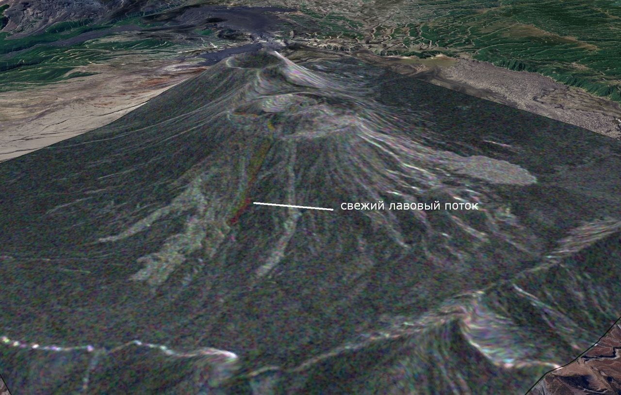
This particular eruption is characterized by its effusive nature, meaning the mountain is not producing violent explosive ash plumes but rather a steady, controlled outpouring of liquid magma. Red-hot rivers of lava are meticulously descending the volcano’s eastern flank. As these incandescent streams advance, they dynamically alter their trajectories, occasionally converging, overlapping, and solidifying to form a complex, layered-block terrain – a testament to the Earth’s continuous geological sculpting.
Monitoring this majestic but powerful natural phenomenon is a testament to cutting-edge scientific collaboration. Geophysicists from the Institute of Volcanology and Seismology of the Far Eastern Branch of the Russian Academy of Sciences (DVO RAN) are tracking the volcano’s activity with precision, utilizing data from an orbital satellite constellation. A key component of this surveillance is the European radar satellite ‘Sentinel-1,’ highlighting an often-unseen facet of international scientific partnership in addressing global natural phenomena.
The advanced capabilities of Sentinel-1 are crucial for continuous observation, as its radar technology allows scientists to scan the Earth’s surface effectively even through dense cloud cover and volcanic gas, conditions that often obscure traditional optical satellite views. To analyze the eruption’s dynamic evolution, researchers meticulously compared two sets of satellite imagery, captured on February 14 and February 26, 2026, providing a high-resolution window into the molten rock’s progression.
This comparative satellite analysis vividly illustrates the geography of the molten rock’s movement. Areas where the terrain has noticeably transformed between the two observation dates are highlighted in striking red, indicating fresh lava portions still flowing downhill. In contrast, the cooling and already solidified lava flows from earlier stages of the eruption are delineated in a distinct light-grey hue, forming a hardened, stony crust that increasingly encases the volcano’s slopes. This ongoing process offers invaluable insights into effusive volcanic behavior and the ever-changing face of our planet.