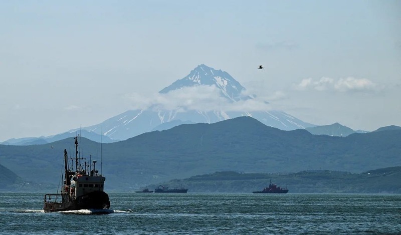
More than a decade of analysis of satellite data has made it possible to identify the key sources of pollution in the Avacha Bay in Kamchatka. The main role in coastal water pollution is played by shipping and discharges of domestic waters. The total area of the identified anthropogenic film pollution of the bay was 332 square kilometers, which corresponds to about 3% of the total area of the water area.
Scientific work on space monitoring was carried out by specialists of the Aerospace Research Institute under the guidance of Academician of the Russian Academy of Sciences, Doctor of Technical Sciences, Professor Valery Bondur. The results of the study have been reported at international conferences and published in the international scientific journal Journal of Marine Science and Engineering (Q1 in the Web of Science database). The research was carried out within the framework of the interdepartmental comprehensive program of scientific research of the Kamchatka Peninsula and adjacent waters in 2024-2026. The coordinator of the program, which unites the efforts of ten scientific organizations, is KamSU. Vitus Bering.
“Work is underway in several areas, including assessing the risks of harmful algal blooms associated with climate change, as well as anthropogenic impacts on Kamchatka’s coastal waters. The research is conducted on the basis of satellite monitoring by collecting and analyzing large volumes of optical and radar images from space. In particular, we have developed and applied a new approach to quantifying pollution in coastal marine areas based on the indicator of the susceptibility of the sea surface to the appearance of film and other anthropogenic pollutants. This indicator takes into account both the area of detected pollutants and the frequency of their occurrence in specific areas of the water area, as well as other important aspects, including hydrometeorological conditions,” explains Valery Bondur.
The research is carried out using both archived and newly received actual space images. From 2014 to 2023, scientists analyzed more than 1.1 thousand archived satellite radar images of the Avacha Bay, including Avacha Bay, on the shores of which the Petropavlovsk-Kamchatsky—Yelizovo—Vilyuchinsk urban agglomeration is located.
An in-depth analysis of the accumulated archival data using the proposed approach made it possible to determine a number of quantitative characteristics of anthropogenic film pollution of the Avacha Bay and compare the results with previously obtained data on the level of anthropogenic pollution of the coastal waters of the Russian sector of the Black Sea.
As a result of processing and analyzing data accumulated from 2014 to 2023, it was shown that the total area of the identified anthropogenic film pollution of the Avacha Bay was 332 square kilometers, which corresponds to about 3% of the total area of the bay. The researchers paid special attention to Avacha Bay as the most polluted part of the bay.
The calculated value of the indicator of the exposure of the Avacha Bay to anthropogenic film pollution indicates that the level of pollution in this water area is relatively high and comparable to the level of pollution in the Russian sector of the Black Sea (approximately 71% relative to the Russian sector of the Black Sea, the results of which were published earlier in the Marine Hydrophysical Journal).
“During 2025, the estimates obtained will be supplemented by the results of the analysis of space images obtained in 2024. The collection of this data (140 radar scenes), as well as their pre-processing, has already been completed. Currently, the collection and pre-processing of satellite images for 2025 has also been launched. An analysis of the results of space monitoring and vessel route maps performed using geoinformation technologies has shown that the detected pollution is largely due to shipping,” explained Viktor Zamshin, Executive Director of the Research Institute, Head of the Aerospace Information Processing Department at the Aerospace Research Institute.
Another source of pollution of the Avacha Bay (especially the Avacha Bay) is discharged domestic water. Researchers at the Aerospace Research Institute conducted a detailed analysis of the pollutants associated with such sources.
Based on the collection, processing and analysis of optical satellite images obtained between 2005 and 2024, more than 100 apparent cases of discharge plumes appearing in the near-surface layer of the water column in Avacha Bay were recorded. Six main areas of regular occurrence of such pollutants have been identified.
One of these areas is a section of the water area near the Chinook municipal sewage treatment plant (Petropavlovsk-Kamchatsky). The largest number of cases of wastewater plumes was recorded in this area: 37 optical anomalies of the near-surface layer of the marine environment associated with discharge plumes were identified during monitoring.
The results obtained emphasize the need for further studies of such types of anthropogenic impacts on the coastal waters of the seas of Russia. Modern methods of remote sensing of the Earth from space make it possible not only to identify sources of pollution, but also to assess their contribution to the overall environmental picture of the region.
Long-term monitoring using satellite data has a number of advantages over traditional observation methods: the ability to cover large areas, the regularity of observations regardless of weather conditions and the availability of territories, and the objectivity of the data obtained. This is especially important for remote and hard-to-reach regions such as the Kamchatka Peninsula.
The approach developed by the specialists of the Aerospace Research Institute for the assessment of marine pollution can be applied to other coastal regions of Russia, which will create a comprehensive system for monitoring the ecological state of the country’s marine areas.
“The results of these studies have concrete practical significance for the economy and ecology of Kamchatka. Data on the pollution of the Avacha Bay directly affect the state of the fishing complex in the region and the quality of marine biological resources. The interagency cooperation under this program allows us to combine scientific knowledge with the practical needs of local businesses and residents. In the educational process, we already use these materials to train environmental specialists who will work here in their native region,” said Olga Rebkovets, Acting Rector of KamSU.
Tatiana Meilakhs (Kommersant)