Against the background of the relentless seismic activity of Kamchatka, a region where the earth’s crust constantly reminds of its power, scientists are preparing to deploy new lines of defense. The Vitus Bering Kamchatka State University Research Laboratory for the Study of Extreme Phenomena plans to significantly expand its geophysical monitoring network in 2025.
As explained by Valery Gavrilov, head of the laboratory, the main goal is to increase the accuracy of forecasts of strong earthquakes that pose a serious threat to the densely populated capital of the region – Petropavlovsk-Kamchatsky. It is planned to install four new high-precision GPS measurement stations, one of which will be located at the strategically important Vilyuchinsky pass.
Gavrilov emphasizes that the decision to expand the network is not accidental. It is based on encouraging experience: shortly before the powerful Shipun earthquake in August 2024, which caused six-point tremors in Petropavlovsk-Kamchatsky, scientists managed to establish a similar point just 20 kilometers from the future epicenter. He notes that thanks to this, unique data was obtained on the processes preceding a strong seismic event at close range. This success gives hope for the possibility of a more timely warning of the danger hanging over the region.
The scientist also reports that in 2025, significant efforts will be directed towards the development of a network of integrated borehole measurements. Special attention is paid to a unique system of electromagnetic measurements using underground electric antennas. Gavrilov points out that it is these data that are now playing a key role in the short-term forecasting of the devastating Kamchatka earthquakes. He states that due to the university’s attraction of new funds for basic research, starting in 2025, large-scale work is planned to modernize and expand the entire network of geophysical monitoring. First of all, as Gavrilov explains, this concerns the Petropavlovsk-Kamchatsky district. The city is located in the zone of possible nine-point earthquakes, and it is here that Kamchatka has the highest population density, which makes it especially vulnerable to the elements.
The Kamchatka Territory is a land that lives in constant tension. More than ten seismic events are recorded here every day, although most of them remain unnoticed by people. However, the memory of the strong aftershocks of 2023 and 2024, and especially the devastating earthquake in spring 2006, after which the village of Korf had to be completely closed and resettled, does not allow us to relax. This constant threat underscores the critical importance of developing monitoring and forecasting systems.
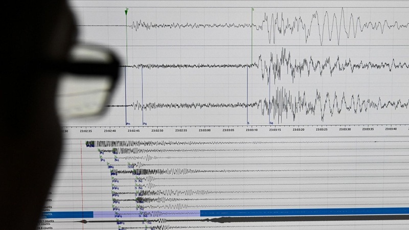
The existing borehole geophysical monitoring network in Kamchatka so far includes only five observation points within a radius of about 100 kilometers around Petropavlovsk-Kamchatsky. Scientists admit that this is not enough to achieve high forecast accuracy, and a much larger number of stations is needed. Kamchatka researchers rely on deep-lying sensors and an integrated approach. The installation of equipment in wells up to a kilometer deep allows you to capture signals that are inaccessible during observations from the earth’s surface. The complexity of measurements, that is, the comparison of data obtained by different methods (for example, seismic and electromagnetic), ensures high reliability of monitoring results of complex earthquake preparation processes.
Olga Rebkovets, Acting Rector of Vitus Bering KamSU, confirms that in 2025, for the first time, the university received a targeted state assignment for conducting geological and geophysical research. This opened up new opportunities for the development of the specialized laboratory. She assures that the university will continue to support the laboratory this year, including by purchasing the necessary modern equipment. Rebkovets emphasizes that this scientific field is of strategic importance for ensuring the safety of the entire Kamchatka region, its inhabitants and the fragile natural environment.